
Outer Banks National Scenic Byway
Posted on 08/26/2015 in Uncategorized.
Outer Banks National Scenic Byway
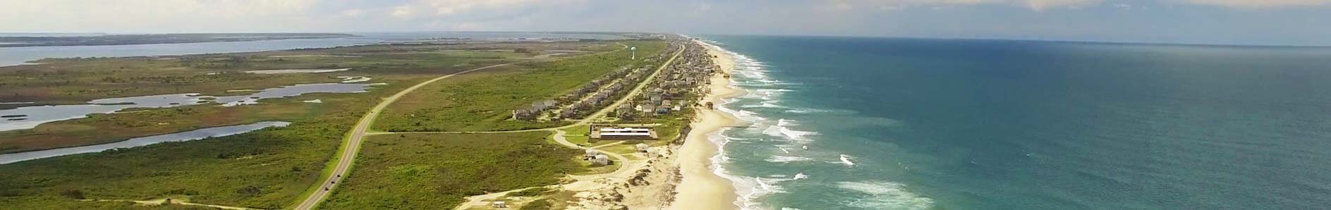
Take the road less traveled. Take the time to experience the actuality of North Carolinas Easternmost parts along the coast of the state’s barrier islands. Currently the Outer Banks National Scenic Byway is made up of nine barrier islands – or banks. The islands protect the mainland coast from the Atlantic Ocean’s, at times, compelling winds and water.
The length of the secluded road is 142.5 driving miles.
The driving time is 6.5 hours – including 3.5 hours on two ferries.
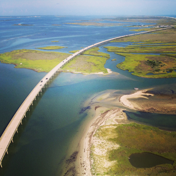
The byway begins in the Outer Banks region and ends in the Crystal Coast region. The Outer Banks National Scenic Byway passes through one of the nation’s great coastal landscapes, tidal marshes, wind-swept dunes, and alluring sounds border the roadway. The byway also includes two national seashores, Cape Hatteras and Cape Lookout. There is two national wildlife refuges – Pea Island and Cedar Island. The barrier islands are separated away from the mainland by six different sounds ranging from three to 40 miles wide. From North to South they are: Currituck, Albemarle, Roanoke, Pamlico, Core and Bogue.

The oceangoing culture of the 21 coastal villages along the road is what makes this route so unique. Each maritime village shares a common cultural heritage which is shaped by the well know barrier islands and three shallow sounds – Pamlico, Core and Back. During the drive visitors will notice that the tiny villages are held together by locally owned businesses with barley a chain business in sight. The residents of these villages build boats, fish and hunt, operate ferries, guard the coast, tell stories and provide services to visitors. Fishing and hunting as livelihoods are keys to this culture that goes along with living on the coastal edge. Byway villages are held to a significant national history, a collection of the nation’s earliest civil works. This includes four historic lighthouses and eight early U.S. Life-Saving Service or U.S. Coast Guard stations. The four lighthouses along the byway are Bodie Island Lighthouse, Cape Hatteras Lighthouse, Ocracoke Village Lighthouse, and Cape Lookout National Seashore Lighthouse.
Take the drive on The Outer Banks National Scenic Byway and get a feel for how life was like before the hectic schedules and tourist-driven cities. The Outer Banks National Scenic Byway begins in the north at Whalebone Junction. The joining of US 64-264, US 158, and NC 12 in Nags Head, Dare County, North Carolina. Travelers following the Byway’s NC 12 south can see the Atlantic Ocean on the east and the Pamlico Sound on the west. The road crosses over Bodie and Hatteras islands in Dare County, Ocracoke Island in Hyde County and Down East in Carteret County to end on the west side of North River at the intersection of US 70 and Merrimon Road. The byway includes two ferry rides. One free, between Hatteras and Ocracoke Islands. The other, between Ocracoke Island and Downs Easts Cedar Island. The Scenic Byway ends in Beaufort in the Down East region of North Carolina.
http://www.visitnc.com/trip-idea/outer-banks-national-scenic-byway-1
http://gardenandgun.com/blog/back-road-trip-outer-banks-scenic-byway
AnimatedGIFs Vol 1. | The Easterns 2014, Jennettes Pier, Nags Head, NC
Posted on 09/15/2014 in Uncategorized.
Animated GIFs | Vol. 1
*Click for full sized images.
THE EASTERNS 2014 | Main Venue Tent

Watching the competitors


Under Jennette’s Pier


Taken at Jennette’s Pier on Monday September 15th, 2014